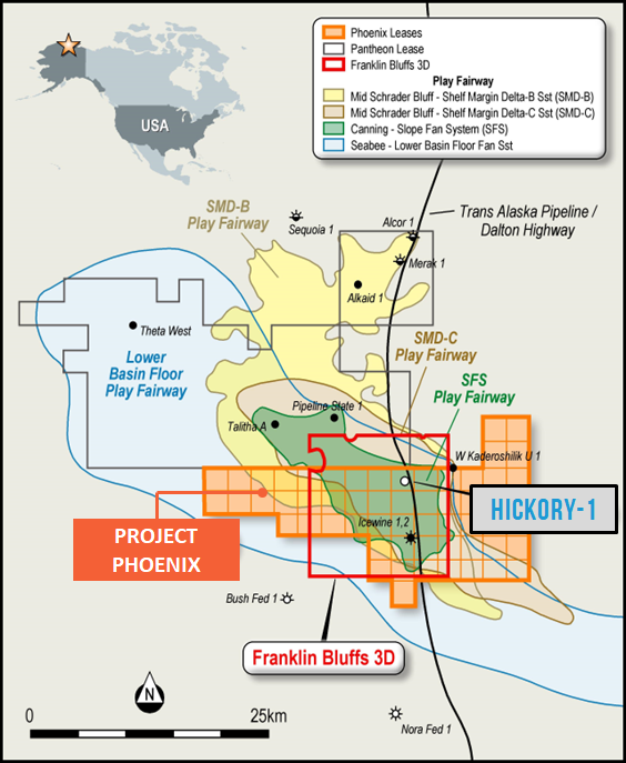
- Situated on the Central North Slope, Alaska and close to existing infrastructure.
- The Company has held the acreage since 2015 and in that time conducted 2 well penetrations, Icewine-1 (2016) and Icewine-2 (2017). Both were designed and drilled to test a deep unconventional play and positive drilling results within the shallower Brookian reservoirs (SMD play) were overlooked due to the different focus of those drilling programs.
- Previously named Icewine East, the renaming to Project Phoenix, reflects the refreshed exploration strategy that focuses on shallow, conventional reservoirs that are proven oil-bearing within adjoining acreage to the North, on correlatable sequences with oil shows in Icewine-1.
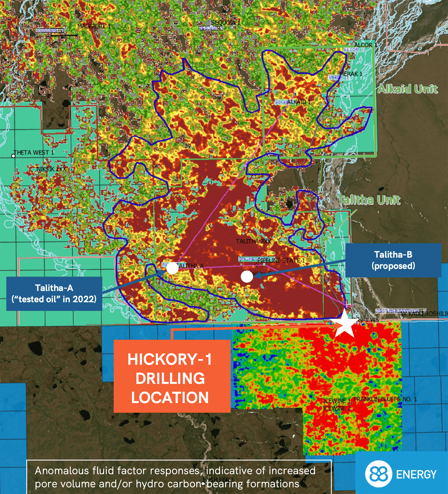
- The project has access to an extensive 2D seismic database that facilitated initial determination of prospective volumes and licensed 225km2 Franklin Bluffs 3D seismic data survey (FB3D) covering the acreage in June 2022.
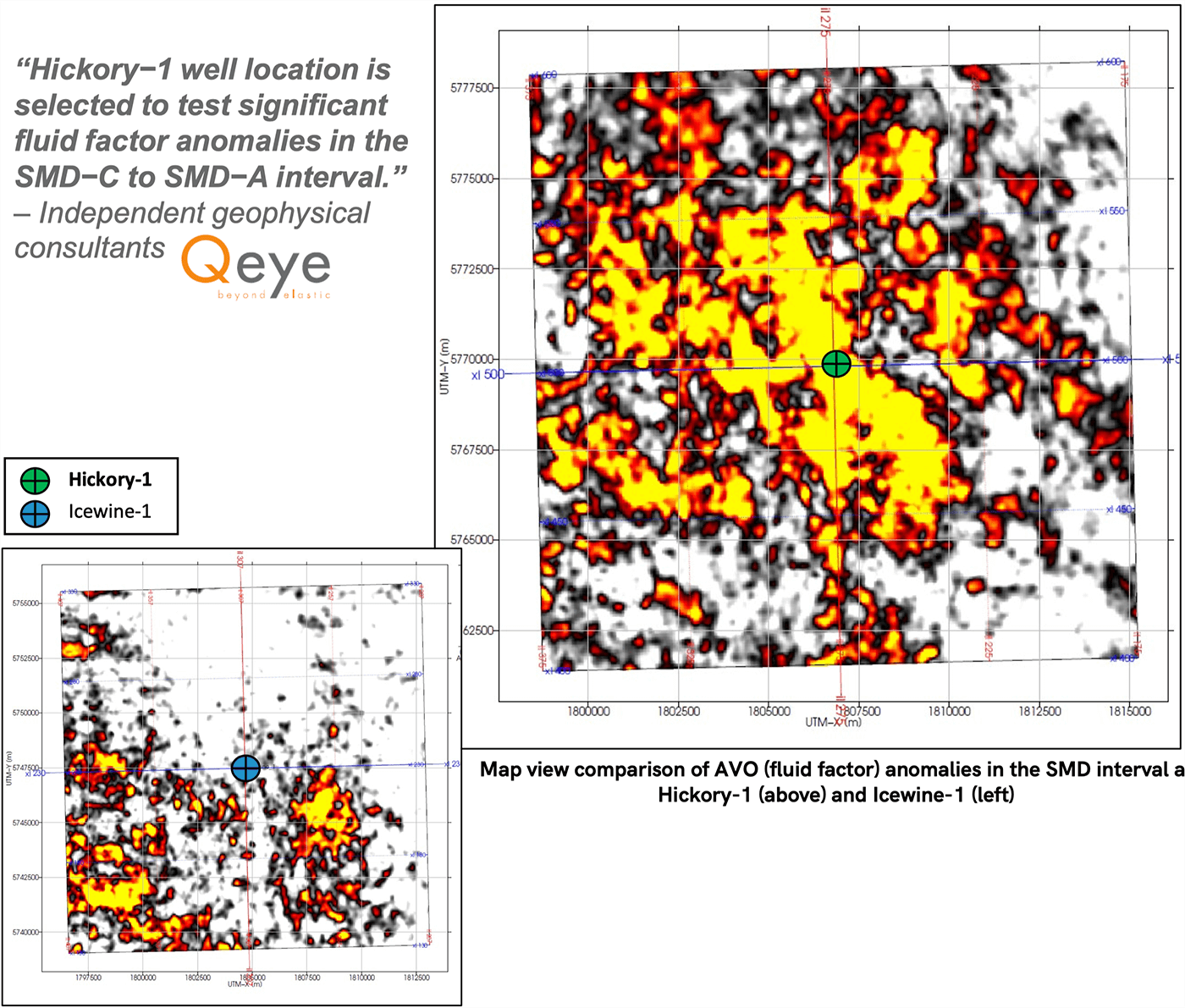
- Seismic studies of the FB3D, including Amplitude Versus Offset (AVO) analysis and seismic inversion were used to optimise the drilling location of Hickory-1.
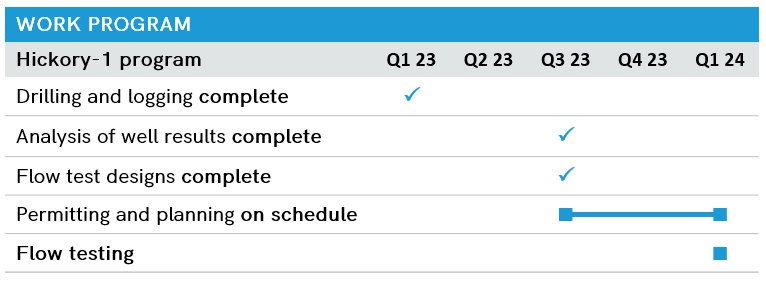
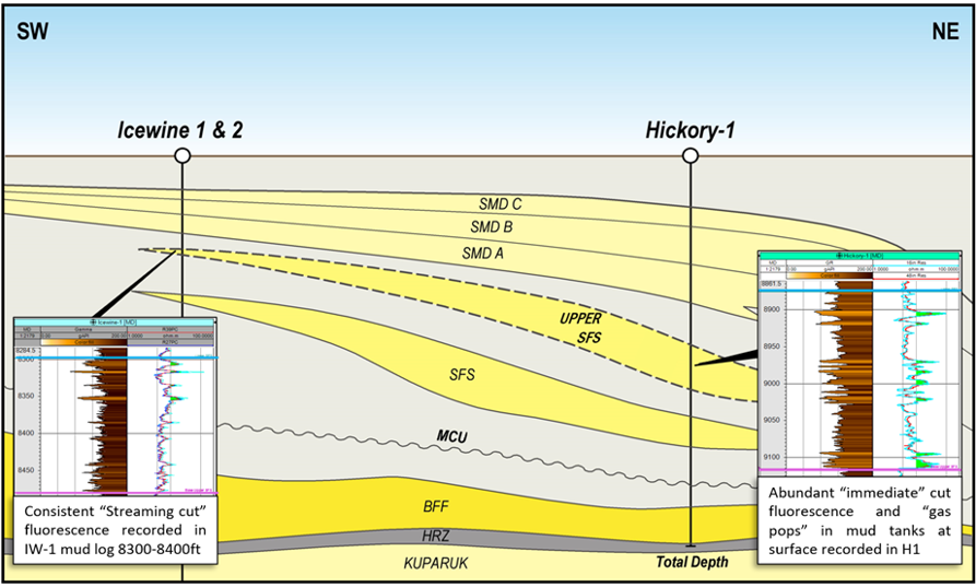
Recent mapping of the Upper sfs reservoir collecting to strong shows in Icewine-1 well and multiple hydrocarbon bearing pay zones to be tested in Q1 2024.
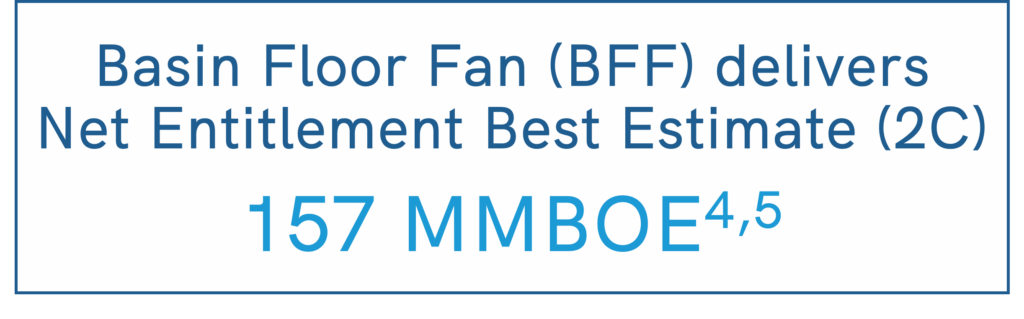
Contingent Resources: Basin Floor Fan Net Entitlement to 88 Energy 4,5
Probabilistic Method Low (1U) Best (2U) High (3U)
Oil Million Barrels 11 28 65
NGL Million Barrels 22 57 137
Oil + NGL Million Barrels 33 85 202
Gas Billion Cubic Feet 160 394 890
Total Million Barrels of Oil equiv. 62 157 364
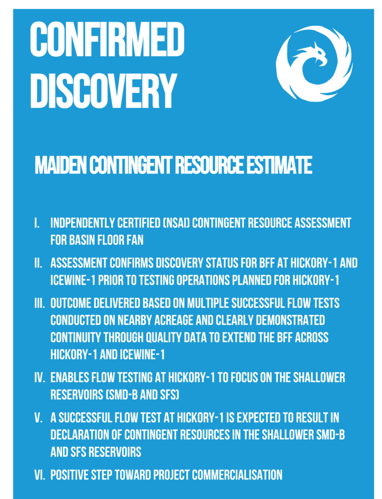
Managing Director, Ashley Gilbert, commented:
“This maiden, Contingent Resource is a great result for 88E and its shareholders. It represents an important milestone on the path to the possible development of Project Phoenix, even prior to flow testing operations at Hickory-1 this upcoming season….”
4. Net entitlement to 88E is approximately 63%
5. Refer to ASX announcement dated 6 November 2023 for full details with respect to the contingent resource estimate, associated risking and Cautionary Statement on page 3
HIGH IMPACT EXPLORATION WELL
- Spud in March 2023 to TD of 10,650ft
- Validated prescence of Multiple Hydrocarbon-bearing zones across all 6 pre-drill targets
- Obtained quality data to optimally design and plan a 2023/24 winter season flow test
- Identified new Upper SFS Reservoir
Strategically located near to infrastructure:
- Deadhorse – North Slope services hub
- Adjacent to Dalton Highway and Trans-Alaska pipeline
- Immediate Export Route
- Expediting future development
- Minimising costs and environmental impact
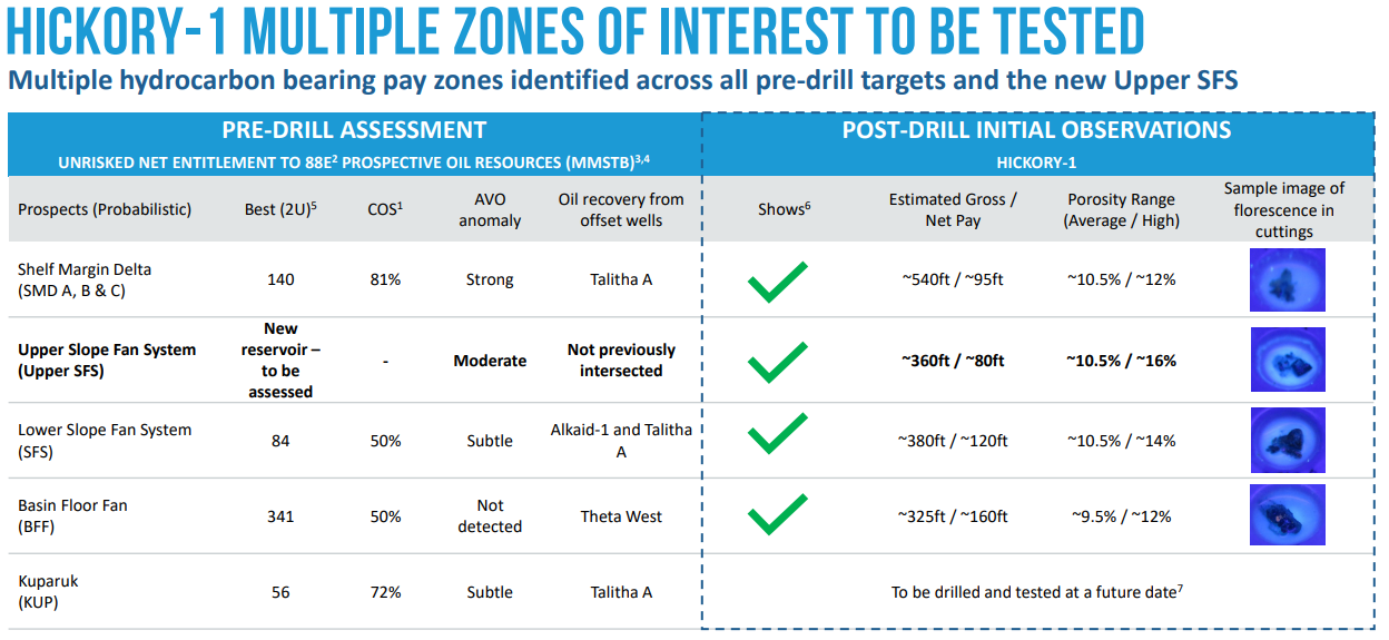
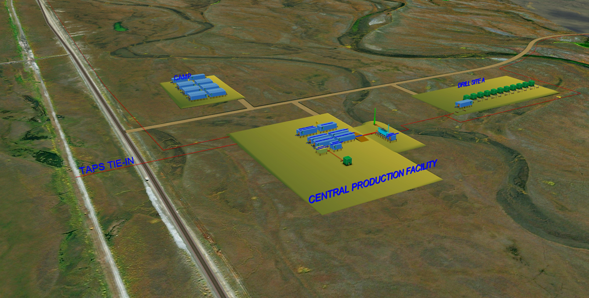
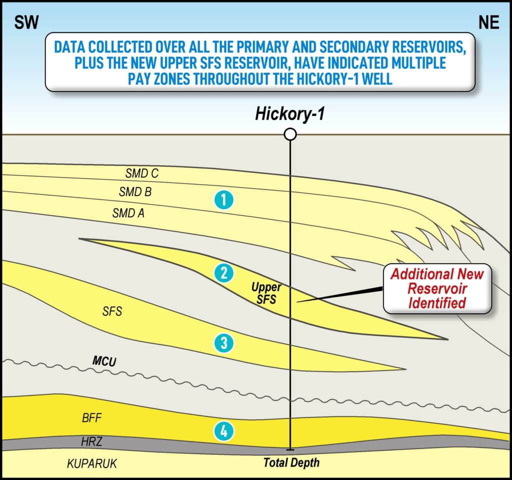
Figure 1: The Hickory-1 flow test is planned to assess up to 4 zones
| NET ENTITLEMENT PROSPECTIVE RESOURCE (MMBO, UNRISKED) | ||||
| Low (1U) | Best(2U) | High (3U) | Mean | |
| Prospects Total | 92 | 280 | 641 | 2901 |
| NET ENTITLEMENT (~63%) CONTINGENT RESOURCES2 | |||
| Low (1C) | Best(2C) | High (3C) | |
| TOTAL MILLION BARRELS OF OIL EQUIVILANT | 62 | 157 | 364 |